1/1
WinGPS™ Marine screenshot 0
WinGPS™ Marine Icon

WinGPS™ Marine

Stentec
Trustable Ranking IconAffidabile
3K+Download
6MBDimensione
Android Version Icon5.1+
Versione Android
4.60(09-02-2024)Ultima versione
4.0
(2 Recensioni)
Age ratingPEGI-3
Come effettuare l'installazione
1
Scarica e apri il file di installazione
2
Unblock AptoideAptoide is a safe app! Just tap on More details and then on Install anyway.
3
Completa l'installazione e apri Aptoide
app-card-icon
InformazioniRecensioniVersioniInformazioni
1/1

Descrizione di WinGPS™ Marine
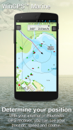
WinGPS Marine offers you modern, easy to learn navigational tools for a safe trip. Long press on the chart to plot your route. The GPS on board will show your exact location. Download the charts to your device and go boating offline with the most up-to-date charts. Connect your AIS via WIFI and prevent possible collisions.

Developed by Stentec for navigation on sailing and motor yachts, sloops and canoes at sea, tidal and inland waters. Ideal when renting or chartering a boat.


NEW [2017]

• Support for the waterways for the inland charts Western Europe and Donau with bridge-, locks and waterway information. With this you can plot and adjust your routes quickly, indicating any obstacles. The names of the waterways and distances will be shown during your trip.

• Smart labeling prevents overlapping text labels (with waterways also) for an optimal chart image. Bridge and lock data will always be readable on Course Up rotating charts.


HIGHLIGHTS

• Navigating on up-to-date charts of Stentec, Imray, NOAA and Delius Klasing.

• SD-card support for chart storage.

• Manage tracks, charts, routes and waypoints.

• NOAA World GRIB-files: wind, air pressure, rainfall and temperature.

• Connect AIS and GPS via wirelesss WIFI or Bluetooth connection.

• Prevent collisions with the speed vectors of the AIS ships.

• Man-overboard button helps to retrieve lost crewmembers.

• Chart moves along underneath centered GPS position. NorthUp, CourseUp (Marine) or HeadUp (Plus).

• Harmoniemodel KNMI with detailed weather predictions (Plus, Netherlands only)

• NOAA wave prediction at open sea (Plus, Worldwide)


When WinGPS Marine is installed for the first time, this will be WinGPS Marine Lite with limited functions. Ideal as a chart viewer with GPS support.


IN-APP PURCHASE

After putchasing WinGPS Marine, you will unlock the full capabilities of your personal navigation system. You are now able to plot routes, download GRIB files, save previous tracks and connect AIS and GPS. Use the handy time table to view the predicted wind, rain, air pressure and AIS targets.

With the WinGPS Marine Plus upgrade, you will be able to connect additional board instruments via wireless connection to you board PC, multiplexer or AIS transponder. You can display current and tidal information in your data plotter or view it on the chart. Also, the advanced KNMI’s Harmonie weather model is supported as well as the NOAA waves worldwide.

KUSTFIJN Getijmodel Rijkswaterstaat with two day wind depended predictions of currents, tides and water levels on the Waddenzee, Ijsselmeer, Markermeer, Randmeren and Zeeland. Red depth lines limit the safe waterways depending on depth, tides and deviations because of the wind.


CHART COVERAGE & INSTALLING THE CHARTS

When you start WinGPS Marine you will automatically see the (online) topographic default chart of ESRI. You can also turn on the NOAA charts of the US and download the free world chart via the Chart Manager


For safe navigation, you can purchase digital charts at www.stentec.com. It’s also possible to purchase the charts in the app or via Google Play™. Your charts can be installed on 3 different devices. For example, on your Android tablet, phone and Windows laptop or computer.


Log in with your Stentec Account in the Marine app and download or update your purchased DKW2 charts in the Chart Manager.

For example, the popular DKW1800 series with weekly BaZ updates and the NL Chart with biweekly updates. Our online shop offers up-to-date sea charts and all inland charts of Western Europa including the Donau.


With the DKW Builder (optionally), you can use scanned or BSB charts to build your own DKW2 chart set. The new DKW2 charts can be copied to the DKW2 folder on your tablet via a USB cable to use the charts in WinGPS Marine.


More information: www.wingpsmarine.com


USERS INPUT

For improvement of the app we are very much interested in your experience and suggestions. Please send an e-mail to helpdesk@stentec.com.

WinGPS Marine offre voi moderna, facile da imparare strumenti di navigazione per un viaggio sicuro. Premere a lungo sul grafico per tracciare il percorso. Il GPS di bordo mostrerà la vostra posizione esatta. Scarica i grafici per il dispositivo e andare in barca non in linea con la maggior parte dei grafici up-to-date. Collega il tuo AIS via WIFI e prevenire possibili collisioni.

Sviluppato da Stentec per la navigazione su vela ea motore, sloop e canoe nelle acque marine, delle maree e interne. Ideale quando affittare o noleggio di una barca.


NUOVO [2017]

• Supporto per i corsi d'acqua per le classifiche interne dell'Europa occidentale e Donau con di ponti, serrature e le informazioni corso d'acqua. Con questo si può tracciare e modificare i percorsi in modo rapido, indicando eventuali ostacoli. I nomi dei corsi d'acqua e distanze verranno mostrati durante il viaggio.

• Smart etichettatura impedisce etichette di testo sovrapposte (con corsi anche) per un'immagine ottimale grafico. Ponte e bloccare i dati saranno sempre leggibili su Corso fino classifiche rotanti.


METTE IN RISALTO

• Navigazione su up-to-date grafici di Stentec, Imray, NOAA e Delius Klasing.

• Supporto SD-card per immagazzinaggio della carta.

• Gestione dei brani, grafici, rotte e waypoint.

• GRIB-files NOAA mondo: vento, pressione dell'aria, le precipitazioni e la temperatura.

• Collegare AIS e GPS tramite wirelesss Wi-Fi o connessione Bluetooth.

• evitare collisioni con i vettori di velocità delle navi AIS.

• Pulsante dell'uomo a mare aiuta a recuperare i membri dell'equipaggio persi.

• Grafico si muove lungo la posizione GPS sotto centrato. Northup, CourseUp (Marine) o HeadUp (Plus).

• Harmoniemodel KNMI con dettagliate previsioni meteo (Inoltre, solo Paesi Bassi)

• previsione onda NOAA in mare aperto (più, in tutto il mondo)


Quando WinGPS Marine viene installato per la prima volta, questo sarà WinGPS Marine Lite con funzioni limitate. Ideale come un visualizzatore grafico con supporto GPS.


ACQUISTO IN APP

Dopo putchasing WinGPS Marine, si sblocca tutte le funzionalità del sistema di navigazione personale. Si è ora in grado di tracciare percorsi, scaricare i file GRIB, salvare le tracce precedenti e collegare AIS e GPS. Utilizzare la tabella tempo utile per visualizzare il vento, la pioggia, la pressione dell'aria previsto e bersagli AIS.

Con l'aggiornamento WinGPS Marine Inoltre, si sarà in grado di collegare gli strumenti di bordo aggiuntivi tramite connessione wireless a salire a bordo PC, multiplexer o AIS transponder. È possibile visualizzare le informazioni correnti e delle maree nel vostro tracciatore di dati o visualizzarlo sul grafico. Inoltre, il modello tempo Harmonie l'avanzata del KNMI è supportato così come le onde NOAA in tutto il mondo.

KUSTFIJN Getijmodel Rijkswaterstaat con due giorni di vento dipendeva previsioni delle correnti, delle maree e livelli di acqua sul Waddenzee, IJsselmeer, Markermeer, Randmeren e Zelanda. Rosso linee di profondità limitano le vie sicure seconda della profondità, maree e deviazioni a causa del vento.


TABELLA DI COPERTURA e installare l'ALBERI

Quando si avvia WinGPS Marine si vedrà automaticamente la (on-line) Tabella topografica di default di ESRI. È anche possibile accendere le carte NOAA degli Stati Uniti e scaricare la tabella mondo libero tramite il Gestore


Per la sicurezza della navigazione, è possibile acquistare i grafici digitali a www.stentec.com. E 'anche possibile acquistare le carte in app o tramite Google Play ™. I grafici possono essere installate su 3 diversi dispositivi. Ad esempio, sul tablet, telefono e Windows computer portatile o Android.


Esegui il login con il tuo account Stentec in app Marine e scaricare o aggiornare i grafici DKW2 acquistati nel Gestore.

Ad esempio, la serie DKW1800 popolare con gli aggiornamenti settimanali Baz e il grafico NL con gli aggiornamenti bisettimanali. Il nostro negozio online offre up-to-date carte nautiche e tutti i grafici interne di Europa occidentale oltre il Danubio.


Con la DKW Builder (opzionale), è possibile utilizzare i grafici digitalizzate o BSB per costruire il proprio set grafico DKW2. I nuovi grafici DKW2 possono essere copiati nella cartella DKW2 sul tablet tramite un cavo USB per utilizzare i grafici in WinGPS Marine.


Per maggiori informazioni: www.wingpsmarine.com


UTENTI INGRESSO

Per il miglioramento delle app siamo molto interessati a vostra esperienza e suggerimenti. Si prega di inviare una e-mail a helpdesk@stentec.com.


WinGPS™ Marine - Versione 4.60

(09-02-2024)
Altre versioni
Che cosa c'è di nuovoUpdates:- Improvements in stability

Non ci sono ancora recensioni né valutazioni! Per essere il primo a lasciare un commento,

-
2 Reviews
5
4
3
2
1
Info Trust Icon
Ottima App garantitaQuesta applicazione ha superato il test di sicurezza per virus, malware e altri attacchi dannosi e non contiene minacce.

WinGPS™ Marine - Informazioni APK

Versione APK: 4.60Pacchetto: com.stentec.wingps_marine_lite
Compatibilità Android: 5.1+ (Lollipop)
Sviluppatore:StentecInformativa sulla Privacy:http://www.stentec.com/en/?option=com_content&view=article&id=1848Autorizzazioni:17
Nome: WinGPS™ MarineDimensione: 6 MBDownload: 2KVersione : 4.60Data di uscita: 2024-04-04 10:27:13Schermo minimo: SMALLCPU Supportate:
ID del pacchetto: com.stentec.wingps_marine_liteFirma SHA1: B5:7C:6C:C6:52:A9:50:3D:68:E5:5A:C5:D8:20:EC:DC:55:64:5B:3FSviluppatore (CN): Organizzazione (O): StentecLocalizzazione (L): Paese (C): Stato/città (ST):

Ultima versione di WinGPS™ Marine

4.60Trust Icon Versions
9/2/2024
2K download6 MB Dimensione

Altre versioni

4.58Trust Icon Versions
14/11/2023
2K download6 MB Dimensione
4.57Trust Icon Versions
7/11/2023
2K download6 MB Dimensione
4.56Trust Icon Versions
2/11/2023
2K download6 MB Dimensione
4.55Trust Icon Versions
24/10/2023
2K download6 MB Dimensione
4.53Trust Icon Versions
15/8/2023
2K download6 MB Dimensione
4.52Trust Icon Versions
21/7/2023
2K download6 MB Dimensione
4.51Trust Icon Versions
14/7/2023
2K download5.5 MB Dimensione
4.49Trust Icon Versions
24/6/2023
2K download5.5 MB Dimensione
4.45Trust Icon Versions
17/1/2023
2K download6 MB Dimensione

App nella stessa categoria

Potrebbe piacerti anche...